Cincinnati climate in the canal era and later
A coherent set of annual climate data is available for Cincinnati since 1916 from Weather Service records. Earlier data were compiled by Devereaux in 1919, "Weather for Cincinnati Ohio for 130 years" [pdf format]. Also see Horstmeyer 1989 "In search of Cincinnati's weather" [pdf].
Annual precipitation since 1916 
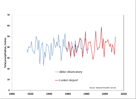
A weather station, the Abbe Meteorological Observatory was maintained on Lafayette Circle, just uphill from the canal site between 1916 and 1982, providing a direct record of temperature and rainfall for the site. For the years since 1982, similar data is available from other nearby stations. In the figure below precipitation records from Abbe and from Lunken Airport can be seen to be closely parallel. Using the combined records,

[full-size image]
spectral analysis identifies two strong cycles with periods 5.7 and 6.6 years. These are both likely an effect of the Pacific Ocean weather cycle, the El Nino - Southern Oscillation (ENSO). A similar cyclicity is found in groundwater levels in wells with long-term monitoring.
Pre-1916 precipitation data
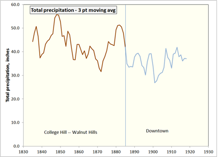
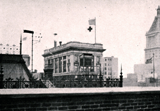
Earlier precipitation and temperature observations were made in College Hill, Walnut Hills, and Downtown (rooftop instruments shown in above photograph from Devereaux 1917). The pattern they reveal is a wetter, more variable climate phase before about 1880 and a drier, less variable rainfall pattern since. [Source data in excel format]

Related webpages
Time series analysis of precipitation data

